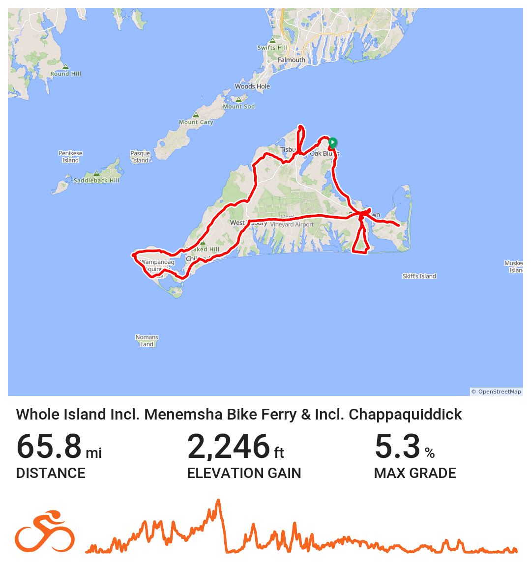
Entire Island #1
Whole Island: Includes Menemsha Bike Ferry & Includes Chappaquiddick
This route:
Includes the Menemsha Bike Ferry to Aquinnah
Includes Chappaquiddick
This route is recommended for any time until September. The Menemsha Bike Ferry stops operating shortly after Labor Day.
This route is approximately 65.8 miles roundtrip. This is the most complete tour of Martha’s Vineyard but arguably the most challenging.
This map includes the entire mainland island plus using the Menemsha Bike Ferry to enter Aquinnah and using the Chappaquiddick ferry to get to Chappaquiddick and East Beach.
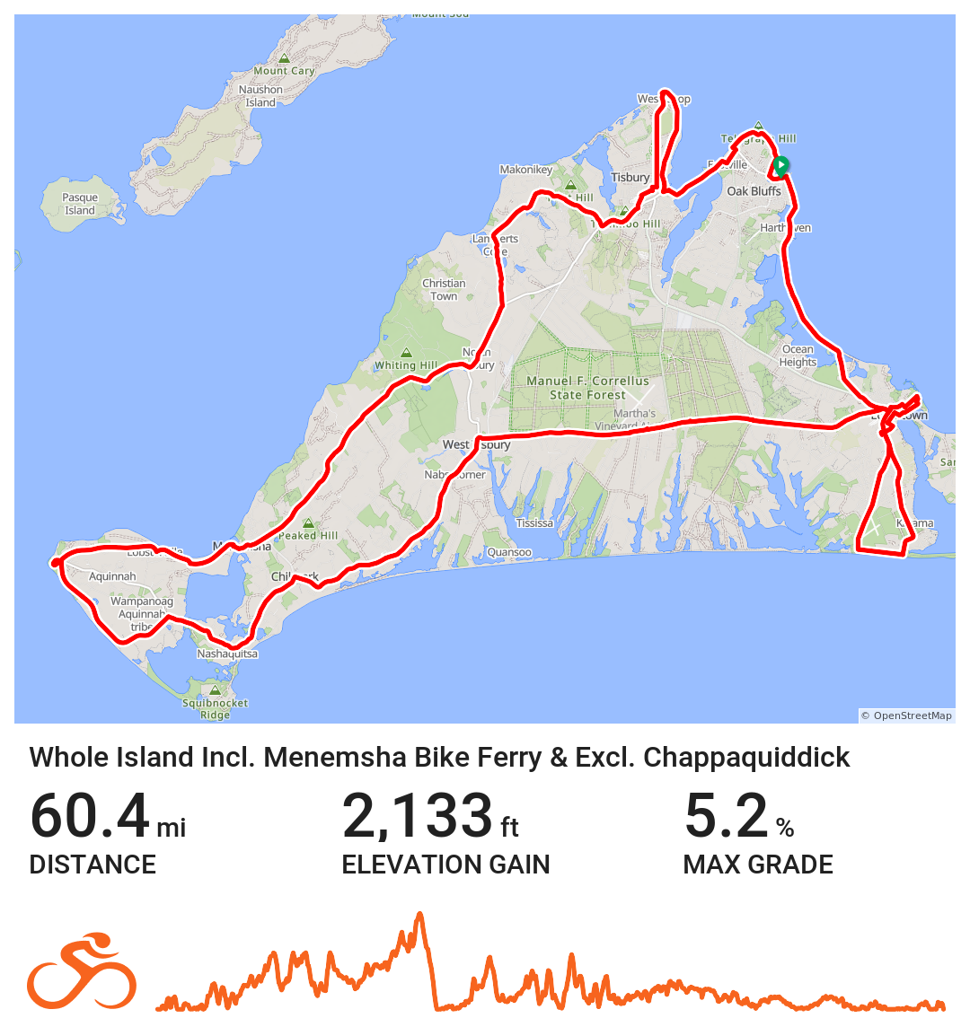
Entire Island #2
Whole Island: Includes Menemsha Bike Ferry & Minus Chappaquiddick
This route:
Excludes the Menemsha Bike Ferry to Aquinnah
Includes Chappaquiddick
This route is recommended year-round.
This route is approximately 68.2 miles roundtrip. This map includes the entire mainland island but does not include the Menemsha Bike Ferry section to enter Aquinnah but does include the portion to Chappaquiddick.
Instead, this route takes riders south on North Road and then southwest on Menemsha Road before going southeast on South Road all the way to the Gay Light Head in Aquinnah before doubling back along South Road all the way through Chilmark and State Road before until the West Tisbury/Edgartown Road appears.
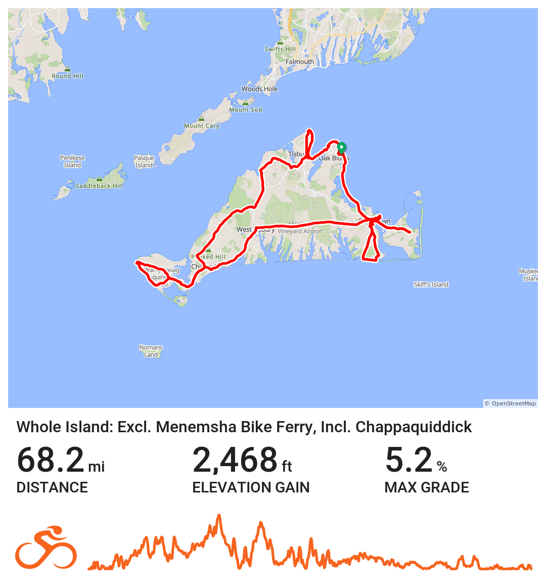
Entire Island #3
Whole Island: Minus Menemsha Bike Ferry, Includes Chappaquiddick
This route:
Excludes the Menemsha Bike Ferry to Aquinnah
Includes Chappaquiddick
This route is recommended for any time until September. The Menemsha Bike Ferry stops operating shortly after Labor Day.
This route is approximately 60.4 miles roundtrip. This map includes the entire mainland island but does not include the Menemsha Bike Ferry section to enter Aquinnah but does include the portion to Chappaquiddick.
Instead, this route takes riders south on North Road and then southwest on Menemsha Road before going southeast on South Road all the way to the Gay Light Head in Aquinnah before doubling back along South Road all the way through Chilmark and State Road before until the West Tisbury/Edgartown Road appears.
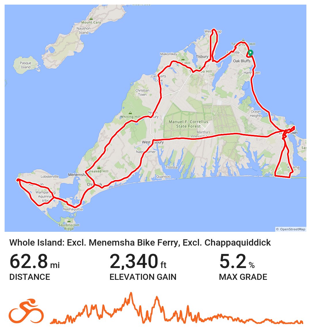
Entire Island #4
Whole Island: Minus Menemsha Bike Ferry, Minus Chappaquiddick
This route:
Excludes the Menemsha Bike Ferry to Aquinnah
Excludes Chappaquiddick
This route is recommended after September as the Menemsha Bike Ferry stops operating shortly after Labor Day.
This route is approximately 62.8 miles roundtrip. This map includes the entire mainland island but does not include the Menemsha Bike Ferry section to enter Aquinnah but does include the portion to Chappaquiddick.
To get to Aquinnah, this route takes riders south on North Road and then southwest on Menemsha Road before going southeast on South Road all the way to the Gay Light Head in Aquinnah before doubling back along South Road all the way through Chilmark and State Road before until the West Tisbury/Edgartown Road appears.
This route also takes users through Edgartown around South Beach but avoids the Chappaquiddick Ferry to take cyclists to Chappaquiddick.
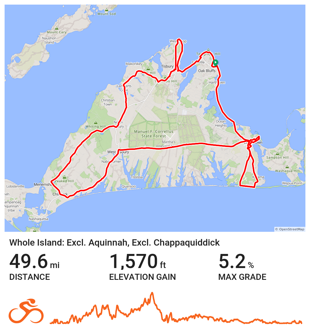
Entire Island #5
Whole Island: Minus Aquinnah, Minus Chappaquiddick
This route:
Excludes all of Aquinnah
Excludes Chappaquiddick
This route is recommended all year round.
This route is approximately 49.6 miles roundtrip. This map includes the entire mainland island but does not include Aquinnah or Chappaquiddick
This route is a good beginner route for those looking to see the entire island. The elevation remains generally consistent throughout and avoids the steep hills of Chilmark & Aquinnah.
